Workshop
Here, More or Less.
Mapping Place, Coordinates and Memory
Program introduction
Here, More or Less. is a participatory workshop exploring the relationship between geographical location, personal memory, photography and GPS data, beginning with Hapjeong as its first site.
Unlike neighbouring areas such as Hongdae or Mangwon, Hapjeong can be difficult to define through a single cultural identity or distinct boundary. Its administrative boundary does not necessarily correspond to how people perceive, name or remember the area. The workshop begins with this ambiguity and asks: Where does a place begin and end? How do we recognise, name and remember where we are?
The session begins with a brief introduction to the historical and cultural transformations of Hapjeong and its surrounding areas, followed by Seyeon Park’s personal memories of growing up around Seogyo-dong and Hongdae and her more recent experience of establishing Happening in Hapjeong.
Participants will then walk through places they perceive as part of Hapjeong and photograph locations that hold a particular memory, association or sense of place for them. Rather than focusing on photographic aesthetics, the photographs function as records connecting a physical location to an individual perception of that location.
A smartphone photograph can contain GPS coordinates — a precise geographical record of where an image was taken. Yet the way a person names, remembers or experiences the same location may be uncertain, subjective and change over time.
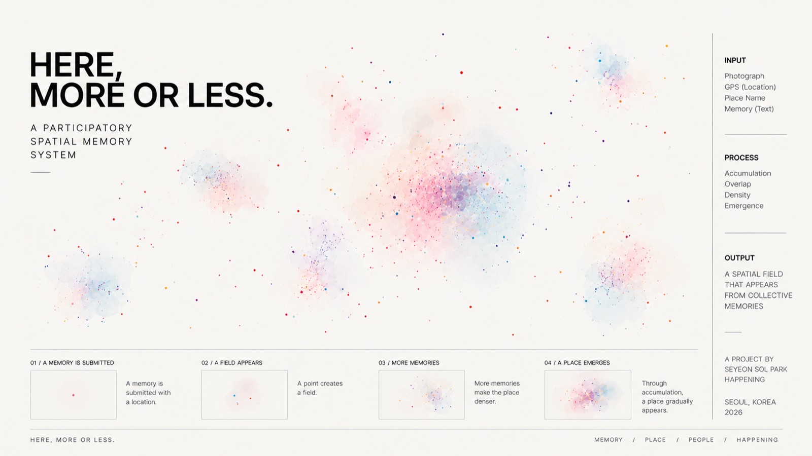
Participants will contribute their photographs, GPS coordinates, names for places and short personal memories to a web-based work. Rather than placing these records onto a pre-existing visible map, the spatial form itself will gradually emerge from the accumulated contributions. Places with only a few records may appear as small fragments, while repeated memories around particular locations may become denser or more defined. New contributions may expand the spatial extent of the work or add greater detail to areas that have already begun to appear.
In this way, precise geographical coordinates become layered with imprecise and subjective memories of place. The project does not attempt to produce an accurate map of Hapjeong. Instead, it explores the difference between location and place — between where a device records us as being and where we understand, remember or describe ourselves as having been.
The resulting work may continue to develop beyond the workshop and exhibition period as a participatory web-based artwork and collective diary of place. As new photographs and memories accumulate over time, the same geographical locations may hold multiple names, experiences and memories from different moments.
Workshop flow
Workshop flow
About Hapjeong
A brief introduction to the historical and urban transformations of Hapjeong and the surrounding Mapo area, from its relationship with the Han River and historical transportation routes to the development of the Hongdae/Seogyo cultural area and present-day Hapjeong.
About Happening
Seyeon Park shares personal memories of growing up around Seogyo-dong and Hongdae, changes she has witnessed in the area, and the process of establishing Happening in Hapjeong. The introduction also considers how Happening occupies and transforms a former karaoke space while retaining traces of its previous use.
Where is Hapjeong?
Participants briefly discuss where they personally think Hapjeong begins and ends. The group considers differences between administrative boundaries and individually perceived boundaries before choosing locations they would like to document.
Photographing Hapjeong
Participants walk through the surrounding area and photograph a location they perceive as part of Hapjeong. When possible, location services should be enabled so that GPS information is embedded in the photograph. The emphasis is not on making a “good photograph,” but on considering why that particular location represents Hapjeong to the participant.
GPS × Memory
Back at Happening, participants locate their photographs through GPS data and add them to a web-based map. Each participant adds a short response to questions such as:
- What do you call this place?
- When is your memory of it from?
- Why did you choose this location?
- What do you remember about it?
Collective Map & Conversation
The group views the accumulated map together and discusses how the same geographical area may contain different names, memories, temporal layers and perceived boundaries.
The session concludes with two questions:
- Can GPS coordinates accurately record a place?
- Are location and place the same thing?